
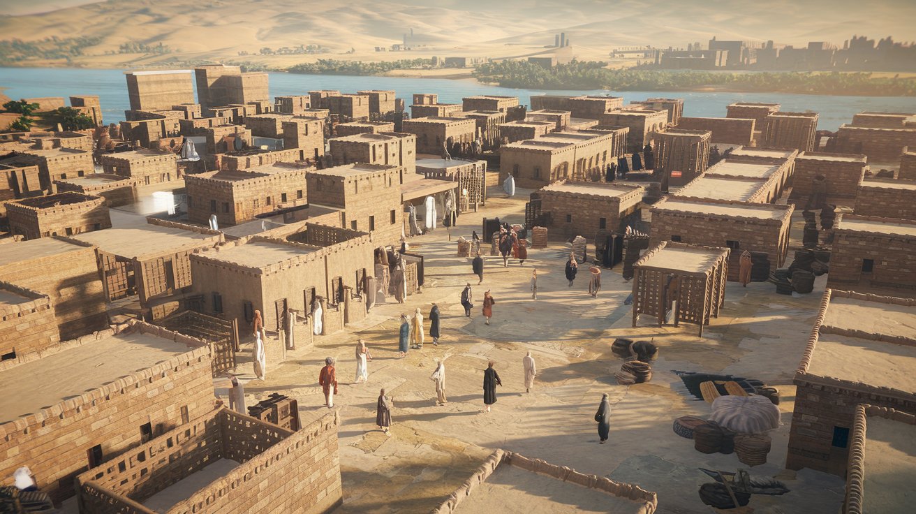
Mesopotamia, known as the cradle of civilization, was located in the region between the Tigris and Euphrates rivers in what is now primarily modern-day Iraq, with portions extending into Syria, Turkey, and Iran. This ancient territory, whose name literally means “land between rivers” in Greek, witnessed the birth of writing, the wheel, and the first cities around 3500 BCE. Understanding where Mesopotamia lies helps us appreciate how geography shaped one of humanity’s most influential civilizations.
The Geographic Location of Ancient Mesopotamia
Ancient Mesopotamia occupied the fertile region between the Tigris and Euphrates rivers, stretching approximately 300 miles wide and 600 miles long. This territory encompassed what we now call the Fertile Crescent, extending from the Persian Gulf in the southeast to the mountains of modern-day Turkey in the northwest. The region’s boundaries were never precisely fixed, as various empires expanded and contracted the territorial control throughout different historical periods from 3500 BCE to 539 BCE.
The geographic coordinates of historical Mesopotamia roughly span from 29°N to 37°N latitude and 39°E to 48°E longitude. This positioning placed the civilization at a crossroads between Asia, Africa, and Europe, making it a natural hub for trade, cultural exchange, and military conquest. The two great rivers provided not only water for irrigation but also transportation routes that connected distant regions, facilitating the spread of ideas, goods, and technologies that would shape Western civilization as we know it today.
Modern Countries Occupying Ancient Mesopotamian Territory
Today, the land that once comprised ancient Mesopotamia is divided among four modern nations, with the vast majority located within Iraq’s borders. Understanding this modern distribution helps contextualize archaeological discoveries and ongoing research in the region.
Iraq: The Heart of Mesopotamia
The majority of ancient Mesopotamia now lies within Iraq, encompassing approximately 75-80% of the historical territory. Major Mesopotamian cities including Babylon, Ur, Uruk, and Nineveh were all located in what is now Iraqi territory. The Iraqi provinces of Baghdad, Basra, Dhi Qar, Wasit, Babylon, Diyala, Saladin, and Ninawa cover the most significant archaeological sites from Mesopotamian civilization. As of 2026, Iraq continues extensive preservation efforts with international partnerships to protect these UNESCO World Heritage sites, despite ongoing challenges related to regional stability and climate change affecting river flows.
Syria, Turkey, and Iran’s Mesopotamian Regions
Syria contains the northwestern portions of ancient Mesopotamia, particularly along the Euphrates River valley in provinces like Deir ez-Zor and Raqqa. Turkey’s southeastern regions, including Şanlıurfa and Mardin provinces, housed the northern boundaries of Mesopotamia and contain important sites like Göbekli Tepe and Harran. Iran’s western Khuzestan province covered the eastern fringes of Mesopotamian influence, where the Elamite civilization interacted closely with Mesopotamian city-states. Together, these three nations account for roughly 20-25% of the ancient territorial expanse, with each country maintaining significant archaeological research programs as of 2026.
What Does Mesopotamia Mean and Why the Name Matters
The term “Mesopotamia” derives from ancient Greek, combining “mesos” (middle) and “potamos” (river) to create the meaning “land between rivers.” This Greek designation was popularized by ancient historians like Herodotus in the 5th century BCE, though the inhabitants themselves never used this term. The indigenous peoples called their land by various names depending on their specific region and time period—Sumerians referred to their land as “Ki-en-gir” (land of the civilized lords), while Akkadians used “mat Akkadi” for their territory.
Understanding the meaning of Mesopotamia clarifies why geography was destiny for this civilization. The two rivers created a unique ecological zone in an otherwise arid region, enabling agriculture through irrigation and supporting population densities impossible elsewhere in the ancient Near East. This naming convention emphasizes how the fundamental geographic feature—the rivers—defined every aspect of Mesopotamian life, from farming cycles to religious beliefs to political organization. In 2026, environmental scientists studying ancient climate data have revealed how Mesopotamian agricultural systems adapted to river fluctuations over millennia.
The Historical Periods and Territorial Changes of Mesopotamia
Mesopotamian civilization evolved through distinct periods, each associated with different territorial extents and political organizations. The region’s history spans over 3,000 years of recorded civilization, making it one of the longest continuous cultural traditions in human history.
Early Mesopotamian Periods: Ubaid Through Akkadian Empire
The Ubaid period (6500-3800 BCE) saw the first permanent settlements along the rivers, establishing the foundation for urban civilization. The subsequent Uruk period (4000-3100 BCE) witnessed the emergence of the first true cities, with Uruk itself reaching populations of 40,000-80,000—unprecedented in human history. The Early Dynastic period (2900-2334 BCE) featured competing city-states like Ur, Lagash, and Kish controlling relatively small territories. The Akkadian Empire (2334-2154 BCE) under Sargon the Great marked the first time a single power unified most of Mesopotamia, extending control from the Persian Gulf to the Mediterranean Sea, covering approximately 250,000 square miles of territory.
Middle and Late Periods: Babylonian and Assyrian Dominance
The Old Babylonian period (2000-1600 BCE) saw Babylon emerge as the dominant power under rulers like Hammurabi, whose famous law code standardized justice across a territory of roughly 50,000 square miles. The Middle and Neo-Assyrian periods (1365-609 BCE) expanded Mesopotamian control to its greatest extent, with the empire at its peak under Ashurbanipal controlling territory from Egypt to Iran and from Turkey to the Arabian Peninsula—approximately 540,000 square miles. The Neo-Babylonian Empire (626-539 BCE) represented the final flowering of native Mesopotamian power before Persian conquest, with Nebuchadnezzar II controlling the fertile crescent and building the famous Hanging Gardens of Babylon around 600 BCE.
Mesopotamia’s Oldest Cities and Their Modern Locations
Identifying the oldest cities in Mesopotamia provides concrete geographic anchors for understanding this ancient civilization. Archaeological evidence reveals several candidates for the world’s oldest continuously inhabited urban centers.
Eridu and Uruk: Competing Claims for Oldest City
Eridu, located near modern Tell Abu Shahrain in southern Iraq’s Dhi Qar Governorate, claims the title of oldest Mesopotamian city with settlement evidence dating to approximately 5400 BCE. Sumerian mythology identified Eridu as the first city ever created, home to Enki, the god of wisdom and fresh water. However, Uruk (modern Warka), situated about 50 miles northwest of Eridu, became the first true urban center around 4000 BCE, reaching populations that qualified it as humanity’s first actual city with complex social stratification. As of 2026, ongoing excavations using ground-penetrating radar and satellite archaeology have revealed that Eridu’s urban area covered approximately 15 acres at its peak, while Uruk eventually sprawled across 1,000 acres by 2900 BCE.
Ur, Nippur, and Other Major Urban Centers
Ur, located near modern Nasiriyah in southern Iraq, served as one of Mesopotamia’s most important cities from 3800 BCE through 500 BCE, famous as the biblical birthplace of Abraham. Nippur, positioned halfway between Babylon and Ur at modern Nuffar, functioned as the religious center of Mesopotamia for over 3,000 years despite never serving as a political capital. Babylon itself, near modern Hillah, became synonymous with Mesopotamian civilization, reaching its peak around 600 BCE with an estimated population of 200,000—making it the largest city in the world at that time. These cities’ locations along the Euphrates and Tigris rivers, accessible via modern GPS coordinates preserved by Iraqi antiquities authorities, continue to yield archaeological discoveries that reshape our understanding of ancient urban planning in 2026.
Mesopotamia in Biblical and Historical Texts
The Bible references Mesopotamia multiple times, providing important historical corroboration for the region’s significance. The Hebrew Bible uses the term “Aram Naharaim” (Aram of the Two Rivers), appearing in Genesis, Deuteronomy, and Chronicles. Abraham’s journey from Ur of the Chaldees and the later Babylonian exile of the Judeans (586 BCE) represent pivotal biblical narratives tied to specific Mesopotamian locations. The Tower of Babel story, generally associated with Babylon’s ziggurats, reflects ancient impressions of Mesopotamian architectural achievements.
Beyond biblical texts, Greek and Roman historians documented Mesopotamia extensively. Herodotus visited Babylon around 450 BCE and described its walls and hanging gardens. Xenophon’s “Anabasis” provided detailed accounts of traveling through Mesopotamia in 401 BCE. Classical sources consistently portrayed the region as extraordinarily fertile and wealthy, supporting the Greek designation of it as part of the “Fertile Crescent”—a term coined by University of Chicago archaeologist James Henry Breasted in 1914 but describing ancient observations. In 2026, digital humanities projects have created searchable databases of all ancient textual references to Mesopotamia, enabling researchers to track how perceptions of the region evolved across millennia.
The Geography That Created Civilization
Mesopotamia’s geographic features directly enabled the development of complex civilization in ways that isolated factors alone could not. The annual flooding of the Tigris and Euphrates rivers deposited nutrient-rich silt across the floodplains, creating extraordinarily fertile soil that supported intensive agriculture. Unlike Egypt’s predictable Nile floods, Mesopotamian floods were irregular and sometimes destructive, requiring sophisticated irrigation systems and social organization to manage water resources effectively. This necessity drove the development of bureaucratic structures, mathematical systems for land measurement, and written records to track water rights—foundational elements of civilization.
The region’s position as a geographic crossroads facilitated cultural exchange but also made it vulnerable to invasion. Mountains to the north and east provided timber and stone absent from the alluvial plains, necessitating trade networks that extended to Anatolia, the Levant, Iran, and even the Indus Valley. The lack of natural barriers meant that Mesopotamia experienced constant waves of migration and conquest from surrounding peoples—Gutians, Amorites, Kassites, Aramaeans, and others—each contributing to the rich cultural tapestry. Modern climate modeling in 2026 has revealed how subtle shifts in rainfall patterns between 3000-2000 BCE may have driven migrations that repeatedly reshaped Mesopotamian political geography.
Mesopotamian Contributions That Originated From This Location
The geographic specificity of Mesopotamia directly influenced its remarkable innovations. The need to track irrigation schedules and flood cycles led to the development of mathematics, including the base-60 number system we still use for time and angles today. The world’s first writing system, cuneiform, emerged around 3200 BCE specifically to record economic transactions related to temple grain storage and distribution. The wheel, invented in Mesopotamia around 3500 BCE, served initially as potter’s wheels before being adapted for transportation across the region’s flat terrain.
Urban planning, legal codes, and administrative systems all originated in Mesopotamian cities responding to the challenges of managing large populations in river valley settlements. The Code of Hammurabi (1754 BCE) represented the first comprehensive written legal framework, establishing principles of evidence and proportional justice that influence Western legal systems in 2026. Mesopotamian astronomers created the first star catalogs and established the zodiac, driven by agricultural necessity to track seasons. These innovations weren’t abstract developments but practical responses to the specific geographic and environmental conditions of life between the two rivers, demonstrating how location shaped the trajectory of human civilization.
Visiting Mesopotamian Sites in 2026: Modern Accessibility
As of 2026, access to Mesopotamian archaeological sites varies significantly by location and political circumstances. Iraq has made substantial progress in developing cultural tourism infrastructure, with the Iraqi State Board of Antiquities and Heritage partnering with UNESCO to create protected archaeological parks. Visitors can now tour the partially reconstructed city of Babylon, the ziggurat of Ur, and museums in Baghdad and Basra displaying cuneiform tablets and ancient artifacts. Security conditions have improved markedly since 2020, with organized tours operating regularly from major Iraqi cities.
In Turkey, sites like Göbekli Tepe and Harran have become major tourist destinations with modern visitor centers and protective structures preserving the ruins. Syria’s sites remain largely inaccessible due to ongoing instability, though international organizations are cataloging damage and planning future restoration efforts. Iran’s Khuzestan province sites like Susa can be visited with proper permits. American tourists in 2026 can access Iraqi and Turkish Mesopotamian sites through specialized archaeological tour operators, with travel advisories recommending guided tours through established cultural heritage programs. Virtual reality experiences have also become increasingly sophisticated, allowing students and enthusiasts worldwide to explore digitally reconstructed Mesopotamian cities with archaeological accuracy verified by leading institutions.
Environmental Changes Affecting Ancient Mesopotamian Territory
The landscape of ancient Mesopotamia has changed dramatically over millennia, with both the Tigris and Euphrates rivers shifting their courses multiple times due to sediment deposition and tectonic activity. Archaeological surveys using satellite imagery and ground-penetrating radar reveal that many ancient cities once situated along riverbanks now sit several miles from current watercourses. The Persian Gulf coastline has also shifted, with geological evidence suggesting the gulf extended approximately 180 miles further inland around 6000 BCE, meaning cities like Ur were once coastal ports but now sit nearly 150 miles inland.
Climate change in 2026 poses significant threats to both the archaeological heritage and the modern populations living in former Mesopotamian territory. Reduced snowpack in Turkish and Iranian mountains has decreased river flow by an estimated 30-40% since 2000, reviving ancient water conflicts between upstream and downstream nations. Increased soil salinity from millennia of irrigation has made vast areas less productive than in ancient times. Rising temperatures and desertification are expanding the Syrian and Arabian deserts into formerly cultivated areas. International research collaborations in 2026 are using paleoclimatic data from Mesopotamian agricultural records to model historical adaptations to environmental stress, providing potential strategies for modern agricultural resilience in the region.
Related video about waar ligt mesopotamië
This video complements the article information with a practical visual demonstration.
What you should know
Where exactly is Mesopotamia located on a modern map?
Mesopotamia is primarily located in modern-day Iraq, occupying approximately 75-80% of the ancient territory between the Tigris and Euphrates rivers. The remaining portions extend into southeastern Turkey, eastern Syria, and western Iran. Major Iraqi cities like Baghdad, Basra, and Mosul sit within ancient Mesopotamian boundaries. The region spans roughly from 29°N to 37°N latitude and 39°E to 48°E longitude, covering the area known as the Fertile Crescent in the Middle East.
What does the name Mesopotamia mean and who named it?
Mesopotamia means “land between rivers” in ancient Greek, derived from “mesos” (middle) and “potamos” (river). Ancient Greek historians like Herodotus popularized this term in the 5th century BCE, though the indigenous peoples never called it this. Sumerians referred to their land as “Ki-en-gir” meaning “land of the civilized lords,” while Akkadians used “mat Akkadi.” The Greek name emphasized the defining geographic feature—the Tigris and Euphrates rivers—that made civilization possible in this region.
Which modern country was formerly Mesopotamia?
Iraq contains the majority of ancient Mesopotamia’s territory, encompassing most of the historical region between the Tigris and Euphrates rivers. However, no single modern country corresponds exactly to ancient Mesopotamia. The territory is divided among Iraq (approximately 75-80%), Syria (northwestern portions along the Euphrates), Turkey (northern regions in southeastern Anatolia), and Iran (western Khuzestan province). Iraq hosts the most significant Mesopotamian archaeological sites including Babylon, Ur, Uruk, and Nineveh.
What is considered the oldest city in Mesopotamia?
Eridu, located near modern Tell Abu Shahrain in southern Iraq, is considered the oldest Mesopotamian city with settlement evidence dating to approximately 5400 BCE. Sumerian mythology also identified it as the first city ever created. However, Uruk became the first true urban center around 4000 BCE with populations and social complexity that qualified it as humanity’s first actual city. Both sites are located in modern Iraq’s Dhi Qar Governorate, and ongoing excavations continue to refine our understanding of early urbanization timelines.
Can tourists visit ancient Mesopotamian sites today?
Yes, tourists can visit many Mesopotamian sites in 2026, particularly in Iraq and Turkey. Iraq has developed cultural tourism infrastructure with UNESCO partnership, offering tours of Babylon, the Ur ziggurat, and museums in Baghdad and Basra. Security conditions have improved significantly since 2020. Turkey’s sites like Göbekli Tepe and Harran have modern visitor centers. Syrian sites remain largely inaccessible due to instability. American tourists can access Iraqi and Turkish sites through specialized archaeological tour operators, with travel advisories recommending guided tours through established cultural heritage programs.
How has the geography of Mesopotamia changed since ancient times?
The Mesopotamian landscape has changed dramatically over millennia. Both the Tigris and Euphrates rivers have shifted their courses multiple times, leaving ancient cities that once sat on riverbanks now located several miles away from current watercourses. The Persian Gulf coastline extended approximately 180 miles further inland around 6000 BCE, meaning cities like Ur were once coastal ports but now sit nearly 150 miles from the coast. Climate change in 2026 has reduced river flow by 30-40% since 2000, and increased soil salinity has made vast areas less productive than in ancient times.
| Geographic Aspect | Ancient Territory | Modern Location (2026) |
|---|---|---|
| Primary Region | Between Tigris and Euphrates Rivers | Central and Southern Iraq (75-80%) |
| Northern Boundaries | Upper Mesopotamia to Taurus Mountains | Southeastern Turkey (Şanlıurfa, Mardin) |
| Western Extensions | Euphrates Valley Region | Eastern Syria (Deir ez-Zor, Raqqa) |
| Eastern Borders | Zagros Mountain Foothills | Western Iran (Khuzestan Province) |
| Major Ancient Cities | Babylon, Ur, Uruk, Nineveh, Eridu | Near Hillah, Nasiriyah, Warka, Mosul |
| Total Area (Peak) | Approximately 540,000 square miles | Divided among four modern nations |